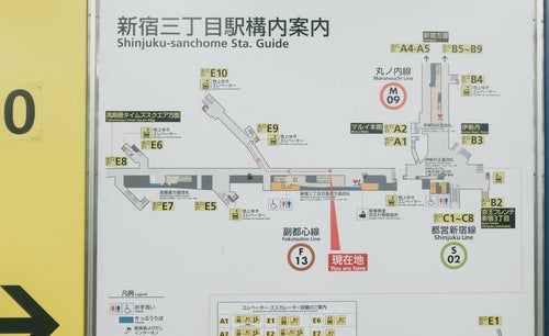
Map of the Shinjuku-sanchome Station Area Free Stock Photo from Japan

map, Shinjuku, Shinjuku-sanchome, station map, exit guide, subway, Marunouchi Line, Fukutoshin Line, Toei Shinjuku Line, route map, tourist map, Tokyo

Area map around Shinjuku-sanchome Station with exits marked by yellow numbers

Cropped materials are also subject to the Terms of Use.

About This Photo

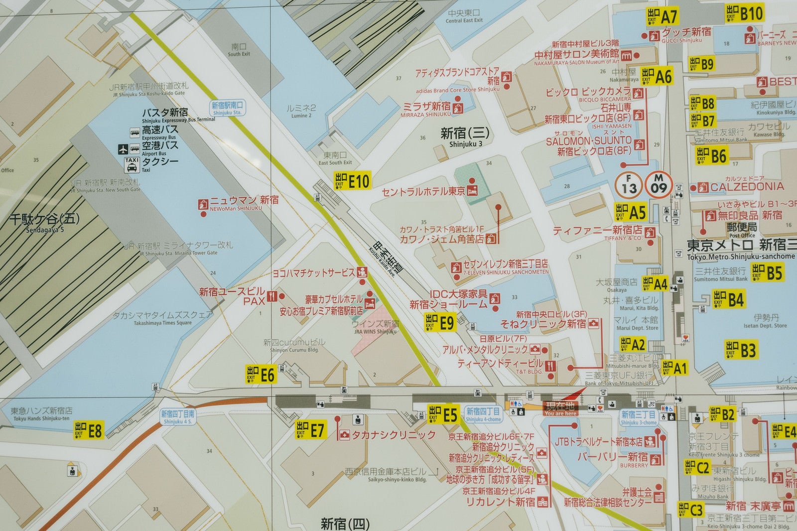
This is a photo of a map of the area around Shinjuku 3-Chome Station. The map shows the station entrances and exits, surrounding roads, and building layouts in detail, with the exits clearly labeled with yellow numbers.

ID Number
18900
Published Date
Color
  • brown
Image Size
  • 5472 px × 3648 px

Free Download (No Registration Required)

The photo material of 'Map of the Shinjuku-sanchome Station Area' is free for both commercial and non-commercial use. No registration required. Please read the "Terms of Use" before downloading.

Main usage examples include blog headers, YouTube thumbnails, presentation materials, and editorial content.

Keeping it free. Your support is needed

We are seeking support from our community to ensure the continuous operation of this website. Any contribution, large or small, is welcome. Would you consider making a donation to PAKUTASO via PayPal? Your support would mean the world to us.

Explore Free Japanese Stock Photos

From cherry blossoms to samurai, Mt. Fuji to everyday life — discover authentic Japanese photography you won't find anywhere else.