Chikuho Coalfield and Railway Route Map (New Building Exhibition Room, Nogata City Coal Memorial Museum) free stock photo

Chikuho Coalfield and Railway Route Map (New Building Exhibition Room, Nogata City Coal Memorial Museum) - free stock photo

Cropped materials are also subject to the Terms of Use.

About This Photo

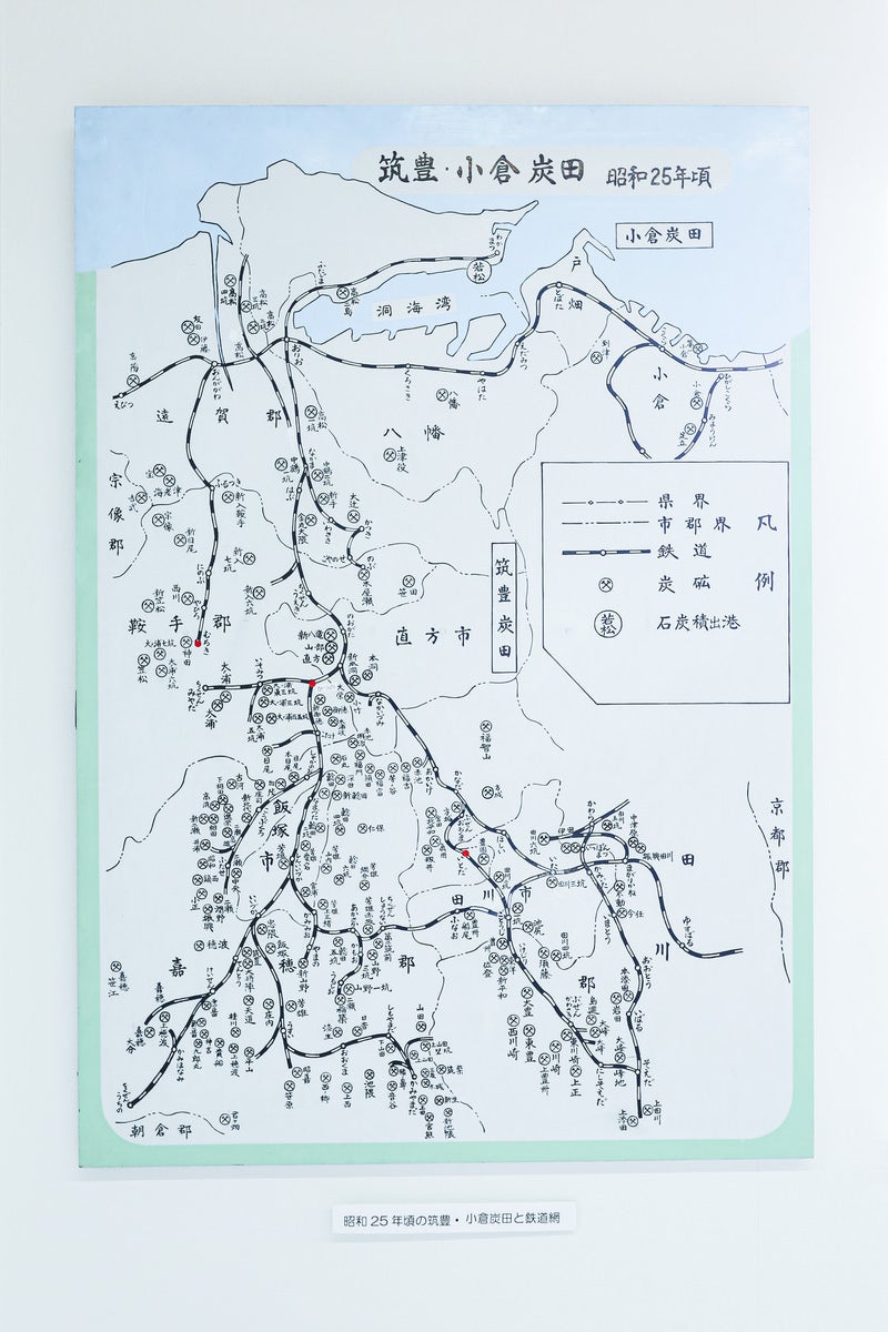
This is a photo of the map of the Chikuho Coalfield and railway lines. It is a historical map displayed in the exhibition room of the Nogata City Coal Museum, which details the distribution of coal fields and the railway network in the Chikuho region. It

ID Number
81097
Published Date
Color
Image Size
  • 3297 px × 4946 px

Free Download (No Registration Required)

The photo material of 'Chikuho Coalfield and Railway Route Map (New Building Exhibition Room, Nogata City Coal Memorial Museum)' is free material that can be used for both commercial and non-commercial purposes without charge. No membership registration is required, and there are no quantity limits or paid sales. Please read the "Terms of Use", and only if you agree, you may use the S/M/L and cropped images.

Main usage examples of photo materials include TV telops, blog eye-catch images, YouTube thumbnails, tracing and sketching, presentation materials, etc.